Modern crashes are no longer explained only through statements from drivers or witnesses. Phones, vehicles, and roadside cameras now generate data that can recreate what happened in seconds before and after impact. This shift has made it harder for conflicting accounts to stand without verification. In many situations involving a car accident, the digital record becomes the most reliable version of events.
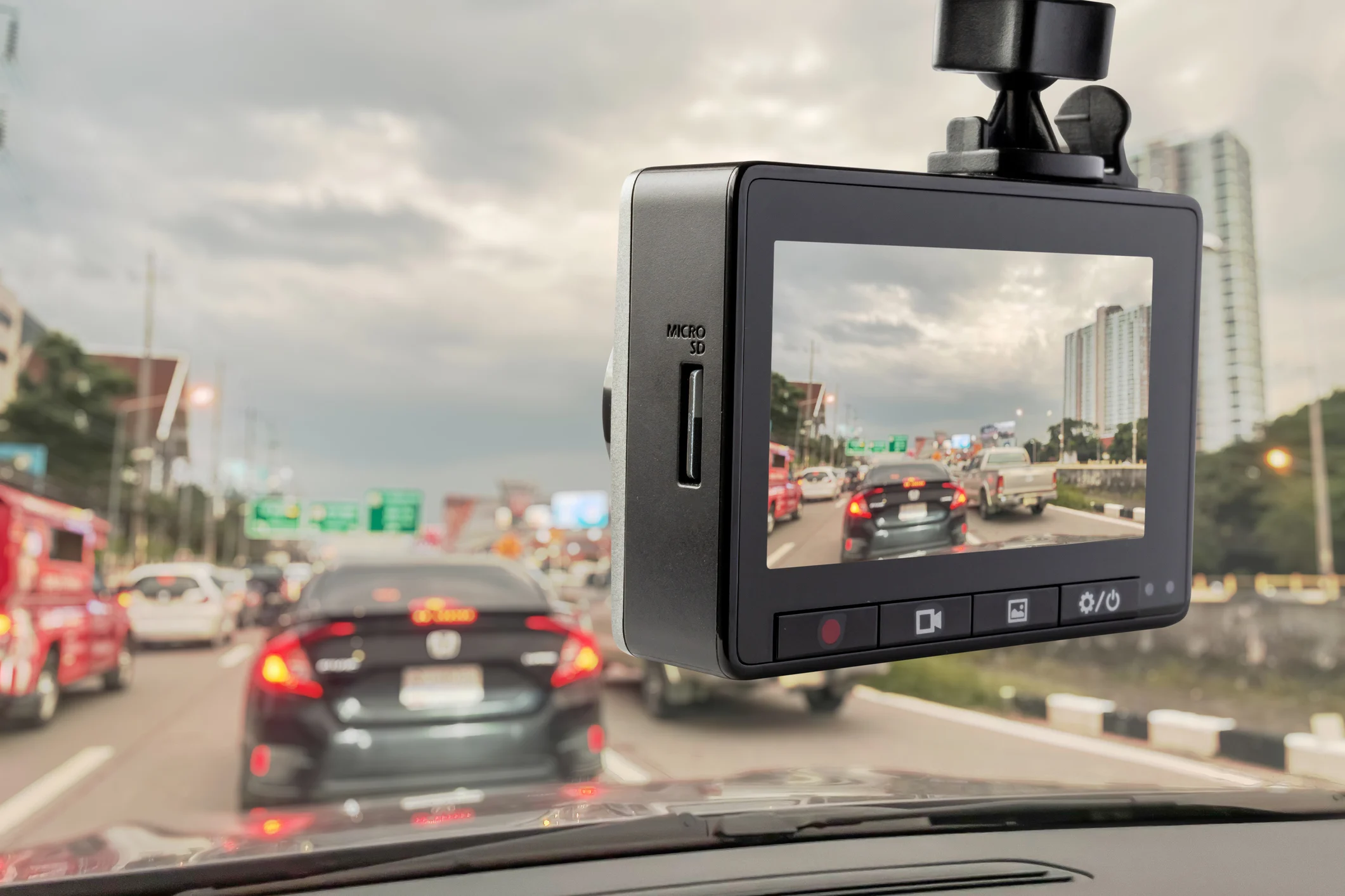
Different systems now contribute pieces of the timeline that used to be lost. Smartphones can capture movement, location, and communication activity before a crash occurs. Vehicles equipped with onboard systems store speed, braking, and steering inputs. Cameras positioned on roads or nearby properties often capture angles that drivers never see in real time.
As these systems evolve, the amount of usable information after a collision continues to grow. Even small fragments of data can help establish a clearer timeline of events. This has changed how investigators and legal professionals approach reconstruction after a car accident. The focus is now on aligning multiple data sources into one consistent sequence rather than relying on memory alone.
How digital evidence is reshaping responsibility after crashes
Evidence collected from devices and connected systems has become a key factor in reconstructing how a collision actually unfolded. Data from smartphones can indicate whether a driver was actively using a device in the moments leading up to impact, while vehicle systems may record braking patterns, speed changes, and sudden acceleration. When combined, these sources often help clarify situations where accounts of a car accident differ or conflict.
Legal review now extends beyond statements and physical damage assessment into detailed technical analysis. Attorneys and accident reconstruction specialists review logs, timestamps, sensor outputs, and sequence data to establish a reliable timeline of events. According to the Weston & Pape legal team based in Orlando, Florida, in many car accident injury cases, this structured approach helps clarify not only how the collision occurred but also how the impact may relate to the severity and timing of injuries. In areas like Orange County, Florida, this type of evidence is increasingly used to resolve disputed claims with greater precision.
Digital records also help reduce uncertainty when multiple parties provide different versions of the same incident. Instead of relying on memory alone, analysts can compare objective data points across devices, vehicles, and external recording systems. This makes it easier to identify inconsistencies and isolate the most accurate sequence of events. Over time, this method has become a standard part of evaluating a car accident within modern legal and injury-focused practice.
Traffic conditions and real driving risks in Orlando
Orlando experiences heavy traffic flow due to daily commuting patterns and tourism activity. Roads often become congested during peak hours, especially near commercial zones and entertainment corridors. Sudden lane changes and distracted driving contribute to frequent collisions across the area. Orlando is a place where a car accident can happen quickly in dense traffic conditions.
Areas such as Lake Nona and Pine Hills reflect different driving environments within the same city. One is shaped by planned residential growth while the other deals with higher traffic density and older road layouts. In both cases, digital evidence often plays a role in explaining what happened after a car accident. The combination of traffic pressure and technology creates a clearer picture of events when disputes arise.
Road conditions also vary depending on time of day and weather patterns. Evening traffic can become more unpredictable due to reduced visibility and driver fatigue. During these periods, recorded data becomes even more important for reconstructing events. This helps ensure that details of a car accident are not lost in fast-moving or unclear situations.
Digital reconstruction of incidents in busy district zones
The Mills 50 District experiences steady traffic from businesses, nightlife, and residential movement. Vehicles often share tight road space with frequent stops and turns, which increases the likelihood of minor and moderate collisions. In such environments, real-time data from vehicles and nearby cameras helps clarify how incidents occur. This is especially useful when drivers recall events differently after a crash.
Traffic patterns in this district also include short-distance trips and frequent pedestrian crossings. These conditions make it difficult to rely solely on verbal accounts after an incident. Recorded data provides a more stable reference point for reviewing a car accident. As a result, technology continues to play a larger role in resolving uncertainty in dense urban zones.
The presence of multiple data sources in one area strengthens reconstruction accuracy. Camera coverage combined with vehicle telemetry can fill in missing moments between impact and reaction. This reduces gaps that often appear in traditional reporting. It also helps establish a more consistent explanation of a car accident in complex district environments.
Road behavior and accident evidence in residential areas
Dr. Phillips is known for a mix of residential streets and commercial activity that brings steady vehicle movement throughout the day. Traffic near shopping and dining areas can become unpredictable, especially during evenings and weekends. These conditions increase the likelihood of sudden braking or intersection-related collisions. A car accident in this environment often requires multiple data sources to explain what occurred.
Neighborhood roads in this area are frequently supported by nearby traffic cameras and vehicle-based recording systems. Data from these sources can show entry speeds, turning behavior, and timing of impact. When combined, this information helps clarify responsibility in situations where drivers have conflicting accounts. It also reduces uncertainty during legal review following a collision.
Additional context from surrounding residential zones also helps build a fuller picture of driving behavior. Patterns such as frequent stops, parking activity, and short local trips can influence how incidents unfold. These details, when captured digitally, strengthen reconstruction accuracy. This makes reviewing a car accident more grounded in measurable evidence rather than assumptions.
How suburban routes and commuter traffic shape crash evidence
Winter Park includes a mix of residential streets, commercial corridors, and commuter routes that stay active throughout the day. Traffic flow can shift quickly depending on school schedules, business hours, and seasonal activity. These variations create conditions where a car accident may not be fully understood without supporting digital evidence. Drivers often rely on memory, but recorded data provides a more accurate sequence.
In many incidents, vehicle systems and external cameras fill gaps left by human observation. GPS data can confirm location and movement patterns before impact occurs. This becomes especially important when determining how and why a collision unfolded in a complex traffic environment. As technology continues to expand, responsibility after a crash is increasingly tied to verifiable digital records rather than recollection alone.
Suburban routes also introduce mixed-speed conditions that complicate reconstruction. Faster through-roads intersect with slower neighborhood streets, creating varied driving patterns. These differences often appear clearly in recorded datasets after a car accident. When analyzed together, they help establish a reliable timeline that supports clearer outcomes in dispute resolution.